Full moon behind the Matterhorn
Computed from Zermatt village, looking south-west up the valley — 8.6 km from the summit — against the real ridge line, not a flat horizon. (46.0207, 7.7491)
The next full moon behind Matterhorn from this viewpoint is Tuesday 23 March 2027 at 04:27 CET, ≈1.4 moon-widths above the ridge (+0.7°) and setting.
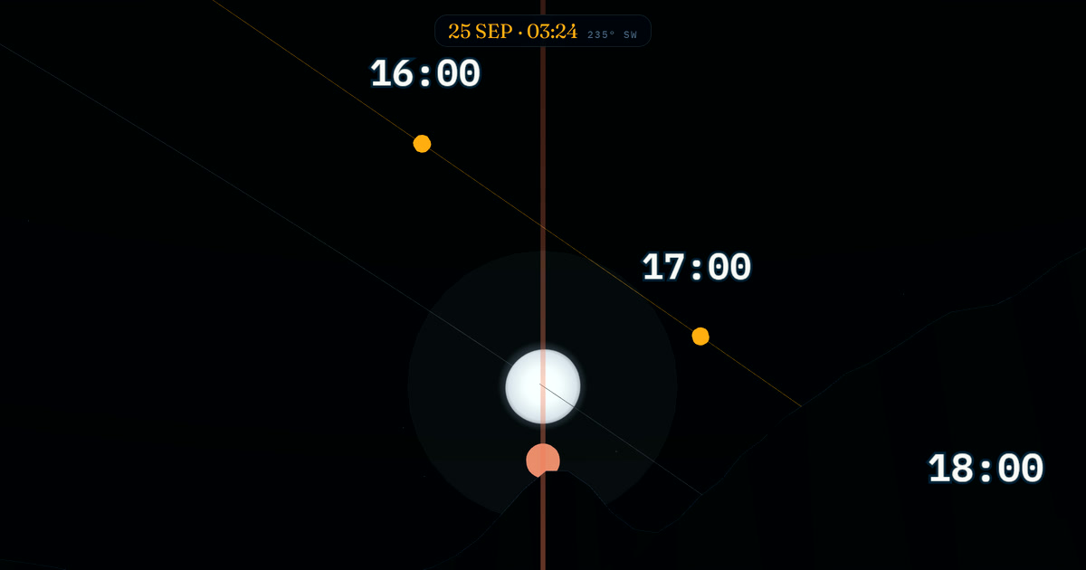
Free, in the browser — the sky view opens at this minute, from this spot, with the real ridge line. Drag the pin to YOUR spot and the whole schedule recomputes.
Upcoming line-ups (next 18 months)
| Date | Time | Moon | Height over ridge | Motion | Preview |
|---|---|---|---|---|---|
| 23 Mar 2027 | 04:27 | 99% | ≈1.4 moon-widths above the ridge (+0.7°) | setting | See it in 3D → |
| 18 Aug 2027 | 05:30 | 99% | ≈1.7 moon-widths above the ridge (+0.9°) | setting | See it in 3D → |
| 12 Mar 2028 | 04:52 | 98% | ≈3.1 moon-widths above the ridge (+1.6°) | setting | See it in 3D → |
All times are local to the viewpoint (Europe/Zurich). Scan window 30 Sept 2026 → 31 Mar 2028. Months not listed have no line-up — the moon crosses this bearing most nights, but rarely full and at ridge height.
Questions
- What does "behind Matterhorn" mean exactly?
- Each row is a minute when the full (≥95%) moon crosses the exact bearing from the viewpoint to the summit, within a few degrees of the ridge height. From 8.6 km away the moon still spans its usual 0.52° — about one fingernail at arm's length — so framing moon and summit together wants a long lens (300 mm+ on full frame; the tighter the row's "height over ridge", the tighter the shot).
- Why does terrain matter?
- A mountain horizon sits degrees above the geometric one. Times computed against a flat horizon can be tens of minutes off, or list nights where the moon never clears the ridge at all. These rows are gated against a 360° elevation ray-cast from the viewpoint.
- Is the moon rising or setting in these shots?
- The Motion column says. A rising line-up means shooting after moonrise (usually evening); a setting one often means a pre-dawn session — plan the hike accordingly.
- What if my spot is different?
- Move the pin. Every preview link opens Heliora with this viewpoint and target pre-set — drag the pin to YOUR spot and the scanner recomputes the whole schedule for it, free, in the browser.
Method
Geometry from astronomy-engine (±1 arcminute, ΔT-corrected). Terrain from AWS Terrarium elevation tiles, ray-cast 360° from the viewpoint (46.0207, 7.7491); reference altitude is the ridge line at the summit bearing (235° SW). Hits require ≥95% illumination and the moon within −0.5° to +4° of the ridge. Times are local to the viewpoint. Accuracy notes: heliora.app/method.